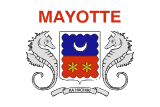
Mayotte
Mayotte
Population
347,500 (2026)
Average Monthly Net Salary (USD)
1,650
Average Mortgage Rate
4.75%
Annual GDP (USD)
N/A
National Debt (USD)
N/A
Unemployment Rate
N/A
Armed Forces (active & reserve)
N/A
Military Expenditure (% GDP)
N/A
Fertility Rate
N/A
Life Expectancy at birth
N/A
Population Growth
N/A
Net Migration
N/A
Notable Facts
Mayotte is an archipelago and overseas department and region of France located in the northern Mozambique Channel in the Indian Ocean, between northwestern Madagascar and northeastern Mozambique. It consists of two main islands, Grande-Terre and Petite-Terre, along with several smaller islets. Unlike the other three islands of the Comoros archipelago, which chose independence in 1974, Mayotte voted to remain under French sovereignty. In 2011, it officially became the 101st French department, marking its full integration into the French administrative and legal systems. This unique political path has resulted in a territory where African, Malagasy, and European influences converge within a modern French framework.
The geography of Mayotte is defined by one of the largest coral lagoons in the world, covering an area of approximately 1,100 square kilometers. This lagoon is enclosed by a double barrier reef, which provides a massive sheltered maritime environment that is vital for the island's biodiversity and local economy. The lagoon acts as a nursery for numerous marine species and is a significant site for the observation of humpback whales and green sea turtles. The deep-water passages through the reef allow for the movement of large vessels, making the lagoon a critical asset for the island’s maritime connectivity and its historical role as a sheltered harbor in the Indian Ocean.
Grande-Terre, the largest island, is characterized by a rugged, volcanic landscape with several prominent peaks, including Mount Choungui and Mount Benara. The terrain is deeply dissected by valleys and covered in a mix of tropical dry forest and cultivated land. Mount Choungui, with its distinctive conical shape, serves as a major landmark and provides a vantage point over the southern part of the archipelago. The volcanic soil is fertile, supporting a variety of agricultural activities, although the steep slopes present challenges for large-scale farming and infrastructure development. The island’s volcanic history is still evident in its basaltic rock formations and various thermal springs.