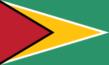
Guyana
Guyana
Population
835,986 (2025)
Average Monthly Net Salary (USD)
410
Average Mortgage Rate
6.75%
Annual GDP (USD)
27,097,477,218 (2025)
National Debt (USD)
4,520,000,000 (2024)
Unemployment Rate
11.96% (2025)
Armed Forces (active & reserve)
3,400
Military Expenditure (% GDP)
0.87% (2024)
Fertility Rate
2.40 (2024)
Life Expectancy at birth
70.3 years (2024)
Population Growth
0.59% (2025)
Net Migration
-5,092 (2025)
Notable Facts
The Cooperative Republic of Guyana is situated on the northeastern coast of South America, bordered by Venezuela to the west, Brazil to the south and southwest, and Suriname to the east. The country’s physical geography is divided into four main regions: a low-lying coastal plain, a white sand belt, the interior highlands, and the southern interior savannahs. Much of the coastal plain, where the majority of the population resides, is situated below sea level at high tide. To manage this, a complex system of dikes, canals, and kokers (sluices) was established, largely based on Dutch hydraulic engineering, to prevent flooding and facilitate drainage for agricultural use.
The Essequibo River is the largest river in Guyana and the largest between the Orinoco and the Amazon. It flows for approximately 1,010 kilometers from the Acarai Mountains near the Brazilian border to the Atlantic Ocean. The river’s estuary is 21 kilometers wide at its mouth and contains several large islands, including Leguan and Wakenaam. The Essequibo basin drains more than half of the country's landmass and serves as a vital artery for the transport of timber and mineral resources from the interior. Its numerous rapids and falls, while hindering continuous navigation, represent significant potential for hydroelectric power generation.
The Pakaraima Mountains dominate the western-central part of the country, forming part of the Guiana Shield, one of the oldest geological formations on Earth. This plateau region is characterized by dramatic "tepuis," or flat-topped sandstone mountains with vertical cliffs. The highest point is Mount Roraima, which marks the tri-point border where Guyana, Brazil, and Venezuela meet. The rugged terrain and high elevation of the Pakaraimas create a unique climate and ecosystem that remains largely isolated from the coastal plains, hosting numerous endemic species of flora and fauna that are not found anywhere else in the world.