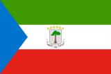
Equatorial Guinea
Equatorial Guinea
Population
1,938,431 (2025)
Average Monthly Net Salary (USD)
625
Average Mortgage Rate
15.00%
Annual GDP (USD)
12,823,210,426 (2025)
National Debt (USD)
4,370,000,000 (2024)
Unemployment Rate
8.34% (2025)
Armed Forces (active & reserve)
1,450
Military Expenditure (% GDP)
0.98% (2024)
Fertility Rate
4.12 (2024)
Life Expectancy at birth
63.9 years (2024)
Population Growth
2.40% (2025)
Net Migration
3,812 (2025)
Notable Facts
Equatorial Guinea is the only Spanish-speaking country in Africa, situated on the west coast of the continent. It possesses a unique geographical configuration consisting of a mainland territory, Río Muni, and five inhabited islands: Bioko, Annobón, Corisco, Elobey Grande, and Elobey Chico. Despite its small size, its maritime borders are extensive, stretching deep into the Gulf of Guinea and providing the country with a vast Exclusive Economic Zone that is the foundation of its modern wealth.
The capital city, Malabo, is not located on the mainland but on the northern coast of Bioko Island. This island is of volcanic origin and is dominated by three extinct volcanoes: Pico Basile, Pico Biao, and Pico Tuñe. Pico Basile is the highest point in the country, reaching an elevation of 3,011 meters. The island’s fertile volcanic soil and high rainfall historically made it a prime location for cocoa plantations. The isolation of the capital from the mainland has necessitated significant investment in maritime and air transport to maintain administrative and economic cohesion between the two primary regions.
The mainland region of Río Muni is bordered by Cameroon to the north and Gabon to the east and south. It is characterized by a coastal plain that rises into the Crystal Mountains, a series of plateaus that form the interior of the territory. The landscape is predominantly covered by dense tropical rainforest, drained by several major rivers, the most significant being the Mbini River (formerly the Benito). This region contains the majority of the country’s landmass and a significant portion of its population, traditionally relying on timber extraction and subsistence agriculture before the oil era.